 |
Oroville
is a small town located in Okanogan County in north-central Washington. As of the 2000 census, the population was 1,653. Oroville was first settled in the late 1850s and known as "rag town." The settlement was named Oro, after the Spanish word for gold, in 1892 after the surrounding gold mines. It was also an attempt to attract more prospectors and merchants to the town. What started as a mining town eventually became a railroad town, then a center to serve the cattle ranchers and farmers in the area. Due to another town with the name "Oro," the name was changed to Oroville in 1909. The town of Oroville began to attract more tourists in the mid-2000s. Oroville still retains a pioneer spirit. It is also a border town. One of the first customs offices for a border crossing east of the Cascades was established in the center of what is now downtown Oroville. Things to do in the town includes visiting the Customs Cabin and The Depot Museum, horseback riding, hiking and biking. Nearby lakes provide lots of opportunities for fishing, swimming, boating, tubing, sailing and water skiing. Oroville is also home to numerous special events throughout the year, including an Ice Fishing Festival, May Festival, CAN-AM hydroplane races, Heritage and Airport Days, The Toast of Orovile - A Grape Experience and the Rendezvous Rhythm and Blues Festival.

|
Oroville Vacation Rentals
|

|
|
|
|
|
Oroville Hotels and Resorts
|
|
|

|
Oroville Weather & Climate
|

|
|
|
Northeast Washington, near the Canadian border, generally has a humid continental climate. Cold air moving southward through Canada will occasionally cross the higher mountains into northern Washington. Although it receives a lot of rain, summers are quite dry. This region is occasionally subject to unusual and harsh weather due to an upper level trough that drives down cold Arctic air from the Canadian interior. This cold air mass can collide with a Gulf of Alaska cold front and create high winds, ice, snow, or heavy rains. Another weather phenomenon, known as the "Chinook wind," happens in the autumn and winter. Unusually warm and steady wind comes out of the south. It is essentially a reverse "Nor'Easter." A Chinook wind following a northeast wind can melt significant snow accumulations very quickly, pushing drainage systems to their limits.
|
| Month |
High Temp |
Low Temp |
Rainfall |
Ocean Temp |
| January |
32°F |
21°F |
1.06 in. |
- |
| February |
41°F |
26°F |
1.01 in. |
- |
| March |
54°F |
31°F |
0.79 in. |
- |
| April |
64°F |
37°F |
0.84 in. |
- |
| May |
72°F |
43°F |
1.37 in. |
- |
| June |
79°F |
49°F |
1.43 in. |
- |
| July |
85°F |
54°F |
0.68 in. |
- |
| August |
85°F |
53°F |
0.68 in. |
- |
| September |
75°F |
45°F |
0.45 in. |
- |
| October |
60°F |
36°F |
0.70 in. |
- |
| November |
43°F |
29°F |
1.24 in. |
- |
| December |
33°F |
23°F |
1.25 in. |
- |

|
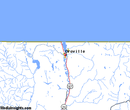
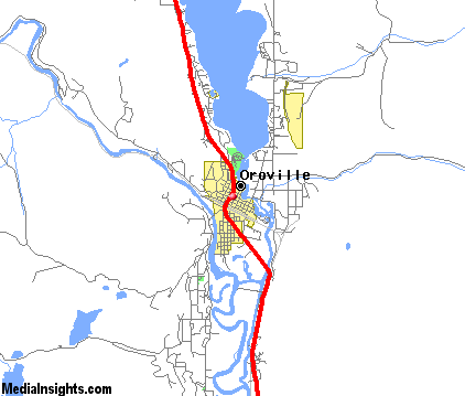
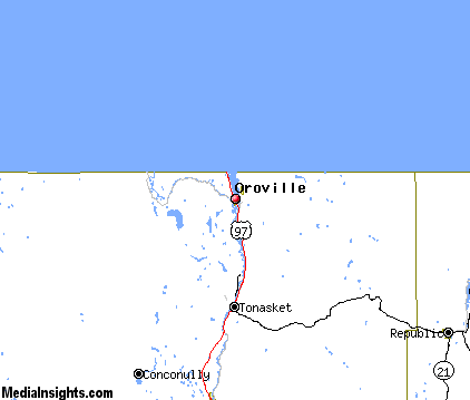
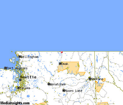
Oroville Map & Transportation
|

|
|
 |
|
|
| Click each thumbnail image to enlarge. |
 |
|
 |
 |
The closest airports in the area are the Methow Valley State airport (S52) located about 48 miles southwest of Oroville in Winthrop, Washington.
|

|
Oroville Attractions
|

|
|
| | | Golf Courses |
| Oroville Golf Club | Oroville | WA | | |
| | | Ski Areas |
| Mission Ridge | Wenatchee | WA | 112.2 mi. | |
| | | State Parks |
| Lake Osoyoos State Park | | WA | 0.2 mi. | | | Lake Osoyoos State Park | | WA | 0.2 mi. | | | Conconully State Park | | WA | 30.5 mi. | | | Curlew Lake State Park | | WA | 39.0 mi. | |
Notice a problem with the information on this page? Please notify us.
|
Disclaimer: We recommend you conduct your own research regarding all accomodations and attractions found on this website. The distances shown on this website are straight-line distances as the crow flies. The road distance may be considerably longer. You assume all liability for use of any information found on this website. No information is confirmed or warranted in any way. By using our services you agree to the terms and conditions of this disclaimer.
|
| We are the #1 site for your Washington Vacation presenting Washington vacation rentals, hotels, weather and map for each city. |
Washington Vacation .com
©1997-2024 All Rights Reserved.
|
|